Advanced Technologies Academy

Capture the Real World. Build Digital Intelligence.

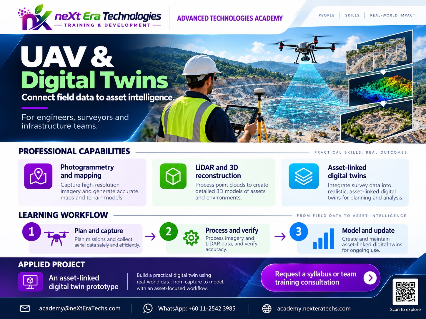
Learn how UAVs, photogrammetry, LiDAR, 3D reconstruction and spatial computing are combined to create accurate digital representations of physical environments, infrastructure and assets.

UAV + Spatial Computing

From Physical Reality to Digital Intelligence

UAVs provide a flexible way to capture high-resolution information about the physical world. When aerial imagery, LiDAR, photogrammetry, positioning data and spatial computing are combined, that information can become measurable 3D data.

Students learn how to move from flight planning and data capture through processing, 3D reconstruction, visualization and digital-twin applications.

LEARN

Understand UAV mapping, photogrammetry, LiDAR, positioning and 3D data principles.

BUILD

Capture and process real spatial data to produce maps, point clouds and 3D models.

APPLY

Use digital models for infrastructure, construction, planning, inspection and analysis.

Curriculum

Explore the UAV & Digital Twins Curriculum

Six progressive technology modules covering spatial foundations, data acquisition, photogrammetry, LiDAR, 3D reconstruction and digital twins.

Illustrative curriculum and project ideas. Field operations require applicable permissions, qualified supervision and local safety procedures. Exact course scope and assessment are confirmed for each offering.

MODULE 01 · UAV & DIGITAL TWINS

UAV & Spatial Foundations

Learn how aircraft, sensors, positioning and geographic data support accurate spatial mapping.

6 curriculum themes · 1 illustrative project

01 / Curriculum focus

  • UAV system fundamentals
  • Aircraft and sensor concepts
  • Flight planning
  • Ground control concepts
  • Coordinate systems
  • Spatial data fundamentals
Suggested entry knowledge

Basic computer literacy, geographic reasoning and introductory mathematics.

02 / Applied practice

  1. Explain UAV components and sensor selection
  2. Identify coordinate reference systems and controls
  3. Draft a basic mapping plan
APPLIED PROJECT IDEA

Design a UAV mapping mission brief

A documented mission plan with sensor selection, study-area coverage, coordinate reference system and a safety checklist.
MODULE 02 · UAV & DIGITAL TWINS

Drone Data Acquisition

Plan repeatable image acquisition, positioning and quality-control procedures.

6 curriculum themes · 1 illustrative project

01 / Curriculum focus

  • Mission planning
  • Image acquisition
  • Overlap and coverage
  • Ground control points
  • GNSS/RTK concepts
  • Data quality checks
Suggested entry knowledge

Module 01 plus mission planning, site assessment and supervised operational safety knowledge.

02 / Applied practice

  1. Calculate coverage and image overlap
  2. Select ground control and positioning methods
  3. Check an imagery dataset for quality
APPLIED PROJECT IDEA

Prepare a supervised UAV acquisition plan

A flight and data-acquisition specification with expected overlap, GNSS/RTK considerations, capture checks and permission requirements.

MODULE 03 · UAV & DIGITAL TWINS

Photogrammetry

Transform overlapping images into spatially referenced imagery, elevations and point clouds.

6 curriculum themes · 1 illustrative project

01 / Curriculum focus

  • Image matching
  • Camera geometry
  • Bundle adjustment concepts
  • Point-cloud generation
  • Orthomosaics
  • Digital surface models
Suggested entry knowledge

Modules 01–02; image geometry, control points and familiarity with mapping software.

02 / Applied practice

  1. Inspect image alignment and camera geometry
  2. Generate orthomosaic and surface products
  3. Evaluate reprojection and spatial errors
APPLIED PROJECT IDEA

Process an aerial imagery dataset

A reproducible photogrammetry report with orthomosaic, surface model, sparse or dense point cloud and accuracy notes.

MODULE 04 · UAV & DIGITAL TWINS

LiDAR & 3D Data

Interpret point clouds and separate ground, structure and vegetation observations.

6 curriculum themes · 1 illustrative project

01 / Curriculum focus

  • LiDAR principles
  • Point-cloud structure
  • Point-cloud classification
  • Terrain extraction
  • 3D measurements
  • Point-cloud quality assessment
Suggested entry knowledge

Spatial coordinates, basic elevation concepts, point-cloud file handling and computer literacy.

02 / Applied practice

  1. Inspect and classify point-cloud observations
  2. Extract a terrain surface
  3. Assess point density and spatial quality
APPLIED PROJECT IDEA

Create a classified terrain model

A classified sample LAS/LAZ point cloud, terrain surface, quality summary and documented measurements.

MODULE 05 · UAV & DIGITAL TWINS

3D Reconstruction

Create accurate meshes, terrain surfaces, buildings and visual 3D assets.

6 curriculum themes · 1 illustrative project

01 / Curriculum focus

  • Mesh generation
  • Textured 3D models
  • Terrain models
  • Building reconstruction
  • 3D visualization
  • Model accuracy assessment
Suggested entry knowledge

Photogrammetry or point-cloud basics; coordinate systems and model validation.

02 / Applied practice

  1. Generate a mesh from spatial data
  2. Apply and inspect textures and terrain
  3. Compare measurements with reference data
APPLIED PROJECT IDEA

Build a georeferenced 3D site model

A textured site or building model with source data, georeferencing, quality checks and interactive viewing.

MODULE 06 · UAV & DIGITAL TWINS

Digital Twins

Connect 3D asset representations with structured attributes, updates and operational data.

6 curriculum themes · 1 illustrative project

01 / Curriculum focus

  • Digital-twin concepts
  • 3D asset representation
  • Spatial databases
  • IoT and sensor integration
  • Asset monitoring
  • Decision-support applications
Suggested entry knowledge

Modules 01–05 or equivalent GIS, 3D-model and database fundamentals.

02 / Applied practice

  1. Structure 3D assets and spatial attributes
  2. Link sample operational or sensor records
  3. Design an update and monitoring workflow
APPLIED PROJECT IDEA

Prototype an infrastructure digital twin

A georeferenced 3D asset view connected to attributes and sample condition or sensor records, with update logic and limitations.

Technology Stack

From Flight Data to Digital Twins

Students learn how multiple technologies work together across the complete spatial data pipeline.

Data Capture

  • UAV Platforms
  • RGB Cameras
  • Multispectral Sensors
  • LiDAR
  • GNSS / RTK
  • Ground Control

Processing

  • Photogrammetry
  • Point Clouds
  • Raster Processing
  • 3D Reconstruction
  • Georeferencing
  • Quality Control

Spatial Intelligence

  • GIS
  • Spatial Analysis
  • Computer Vision
  • Machine Learning
  • 3D Analytics
  • Asset Detection

Digital Applications

  • Digital Twins
  • Infrastructure Monitoring
  • Construction Intelligence
  • Asset Management
  • Urban Planning
  • Environmental Monitoring
Hands-on Projects

Build Real Spatial Systems

Practical projects take students from raw UAV data to measurable 3D information and digital representations.

Project 01 · Mapping & Reconstruction

UAV Photogrammetry Mapping

Build a complete UAV mapping workflow from mission planning through orthomosaic and 3D model production.

  • Flight planning
  • Image quality assessment
  • Photogrammetric processing
  • Orthomosaic generation
  • 3D reconstruction
  • Accuracy assessment
Suggested project deliverable

A documented orthomosaic and 3D mapping workflow with independent accuracy checks and acquisition/safety notes.

Project 02 · Point Clouds & Terrain

LiDAR & 3D Terrain Analysis

Process point-cloud data to create terrain, elevation and 3D representations of a physical environment.

  • Point-cloud processing
  • Classification
  • Ground extraction
  • Terrain modelling
  • 3D measurements
  • Accuracy analysis
Suggested project deliverable

A classified point-cloud dataset, terrain model and measurement report with quality and accuracy analysis.

Project 03 · Assets & Monitoring

Infrastructure Digital Twin

Build a digital representation of an infrastructure asset and connect spatial information with operational data.

  • 3D asset modelling
  • Spatial database
  • Asset attributes
  • Condition information
  • Interactive visualization
  • Monitoring workflow
Suggested project deliverable

An interactive 3D asset prototype linked to structured attributes and sample condition data, with an update workflow.

Project deliverables are illustrative; any real UAV flights require applicable authorizations, qualified supervision and site-specific safety procedures. Independent checkpoints should be used where positional accuracy is claimed.

Learning Journey

Progress from UAV Foundations to Digital Twins

Level 01

UAV Foundations

Level 02

Data Acquisition

Level 03

Photogrammetry & LiDAR

Level 04

3D Spatial Systems

Level 05

Digital Twins

Learning Outcomes

What Students Will Be Able to Do

Explain fundamental UAV and spatial-data concepts.
Plan basic UAV data-acquisition workflows.
Understand photogrammetric reconstruction principles.
Process and inspect point-cloud datasets.
Generate orthomosaics and digital elevation products.
Work with basic 3D spatial models.
Perform spatial measurements and analysis.
Understand LiDAR and point-cloud classification.
Integrate spatial information into asset models.
Design a basic digital-twin workflow.
Evaluate spatial accuracy and data limitations.
Document and present a working 3D spatial project.
Practical Skills

Technical Skills

UAV Mapping Flight Planning Photogrammetry LiDAR Point Clouds 3D Reconstruction GIS Spatial Analysis GNSS / RTK Concepts Digital Elevation Models Computer Vision 3D Visualization Spatial Databases Digital Twins Asset Intelligence
Responsible Spatial Technology

Accuracy, Safety and Data Responsibility

Technical capability must be supported by sound data practices, appropriate operational procedures and clear understanding of measurement limitations.

Data Quality

Understand capture conditions, resolution, coverage and processing errors.

Spatial Accuracy

Evaluate positioning, control points, georeferencing and model accuracy.

Operational Safety

Understand that UAV operations require appropriate local rules and procedures.

Privacy

Consider people, property and sensitive information captured during data collection.

Traceability

Document data sources, processing steps, assumptions and limitations.

DEVELOPMENT WORKFLOW

From Mission to Digital Intelligence

Students follow a repeatable workflow that connects field data acquisition with spatial analysis and digital applications.

  1. 01

    DEFINE

    Establish mission objectives, deliverables and success criteria.

  2. 02

    PLAN

    Plan safe, authorized flights, coverage and data requirements.

  3. 03

    CAPTURE

    Acquire imagery, sensor readings and field measurements.

  4. 04

    PROCESS

    Transform captured data into maps, point clouds and spatial outputs.

  5. 05

    VALIDATE

    Check geospatial accuracy, completeness and data quality.

  6. 06

    ANALYZE

    Extract features, measurements and meaningful spatial patterns.

  7. 07

    MODEL

    Build 3D reconstructions, digital models or twin prototypes.

  8. 08

    APPLY

    Use validated outputs for monitoring, planning and decisions.

Who Should Attend

Built for Learners Who Want to Work with the Physical World

  • Students
  • GIS and Geospatial Students
  • Engineering Students
  • Architecture and Planning Students
  • Data Science Students
  • Environmental Science Students
  • UAV and Mapping Professionals
  • GIS Professionals
  • Technology Professionals
  • Educators and Institutions
Prerequisites

Start with the Right Foundation

Foundation-level programs require basic computer literacy, problem-solving ability and an interest in technology, geography or spatial data.

Advanced projects benefit from basic GIS knowledge, spatial reasoning, statistics and familiarity with data-processing workflows.

Programming experience is useful for advanced spatial analytics and automation, but is not required for introductory UAV programs.

For Schools & Institutions

Bring Spatial Technology Into the Classroom

Programs can be adapted for schools, universities, technical institutions and professional development.

UAV Technology Workshops
Project-Based UAV Programs
UAV Mapping Bootcamps
Photogrammetry Programs
Digital Twin Programs
Faculty Development
Spatial Technology Programs
Custom Institutional Programs
Applications

Where UAV & Digital Twin Skills Are Applied

Construction Monitoring
Infrastructure Inspection
Urban Planning
Surveying & Mapping
Agriculture
Environmental Monitoring
Mining & Resource Management
Disaster Assessment
Asset Management
Smart Cities
Industrial Facilities
Digital Infrastructure
Final Project

Build Your Own Digital Twin

From Real-World Capture to a Working Digital Model

Students complete an applied project that transforms physical-world observations into a structured digital representation suitable for analysis or decision support.

  • Define the physical asset or environment
  • Select appropriate data sources
  • Plan the data-acquisition workflow
  • Process UAV imagery or point clouds
  • Generate a georeferenced 3D representation
  • Create spatial or asset attributes
  • Perform measurements or analysis
  • Validate model quality
  • Document accuracy and limitations
  • Design a digital-twin application
  • Present the completed system
  • Explain technical decisions
neXt Era Technologies Academy

Build the Skills to Shape the Next Era

Learn how UAVs, 3D spatial data and digital twins can turn physical environments into measurable, intelligent digital systems.

Visit the Academy