
ADVANCED TECHNOLOGIES ACADEMY

Build Intelligence for a Changing Planet.

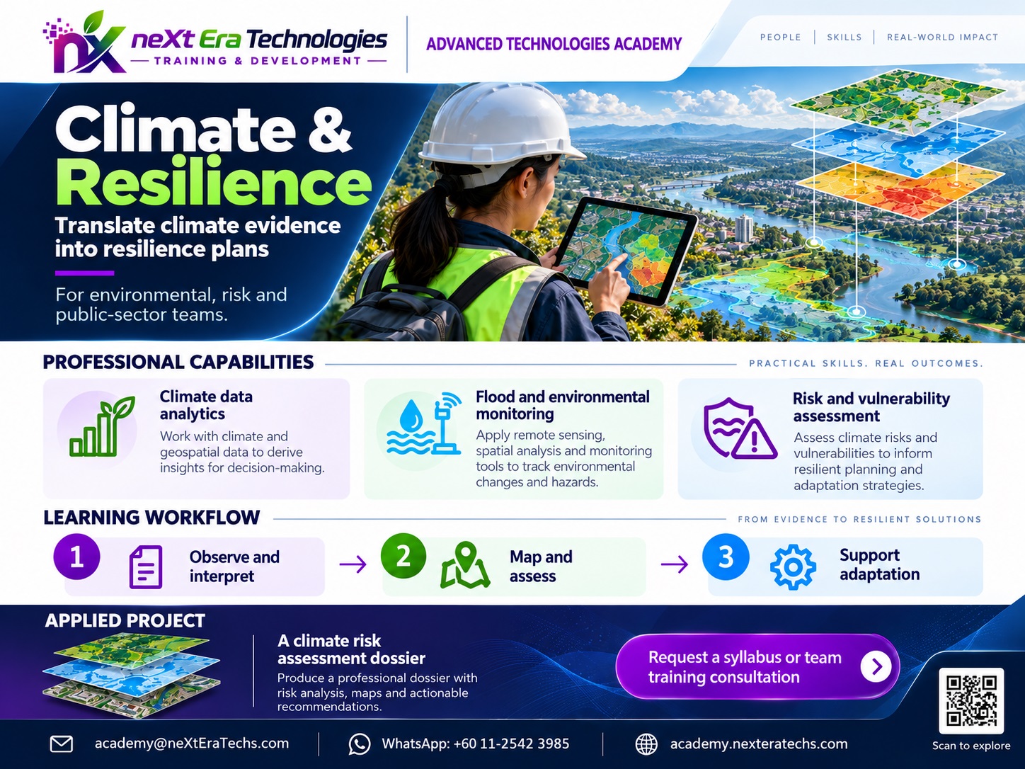
Learn how climate data, Earth observation, geospatial analysis, artificial intelligence and environmental modelling can be combined to understand risk, assess impacts and design more resilient systems.

From Climate Data to Resilience Systems

Climate and environmental systems generate large amounts of information from satellites, weather stations, sensors, geographic databases, models and field observations.

Climate & Resilience training brings these technologies together to help students understand environmental change, identify hazards, assess exposure and vulnerability, analyze potential impacts and support better planning decisions.

Students learn how climate science, data science, geospatial technology and AI can work together in practical systems.

Where are climate and environmental risks concentrated?
How are heat, flooding, drought and other hazards changing?
Which communities, assets and infrastructure are exposed?
How can data support adaptation and resilience planning?
LEARN Understand climate systems, environmental data, risk concepts and analytical methods.
BUILD Develop practical climate analysis, risk mapping, monitoring and decision-support projects.
APPLY Use technology to support cities, infrastructure, agriculture, disaster management and environmental planning.

Climate & Resilience Curriculum

A progressive curriculum connecting environmental foundations, climate data, spatial analysis, AI and resilience engineering.

Illustrative learning activities, entry knowledge and projects are shown below. Confirm course availability, duration, delivery format and assessment requirements before enrollment.

PATHWAY 01 · CLIMATE & RESILIENCE

Climate & Environmental Foundations

Establish the scientific and analytical foundations required for climate and resilience work.

6 curriculum themes · Illustrative applied project

01 Curriculum focus

  • Climate system fundamentals
  • Weather and climate concepts
  • Environmental systems
  • Hazards and exposure
  • Vulnerability and risk
  • Adaptation and resilience concepts
Suggested entry knowledge

Basic computer literacy and environmental curiosity; no coding required at foundation level.

02 What learners can practice

Explain hazard, exposure, vulnerability and resilience using a defined example.

◆ APPLIED PROJECT IDEA

Create an annotated climate-risk concepts map with data-source notes.

Illustrative assignment; scope, resources and assessment criteria should be defined for each course offering.
PATHWAY 02 · CLIMATE & RESILIENCE

Climate Data & Earth Observation

Work with environmental and Earth observation datasets.

6 curriculum themes · Illustrative applied project

01 Curriculum focus

  • Satellite imagery
  • Weather and climate datasets
  • Remote sensing
  • Environmental sensors
  • Time-series data
  • Data preprocessing and quality control
Suggested entry knowledge

Climate foundations, basic data literacy and introductory coordinate-system knowledge.

02 What learners can practice

Import, inspect and quality-check satellite and climate datasets.

◆ APPLIED PROJECT IDEA

Create a small Earth-observation indicator atlas with provenance and missing-data notes.

Illustrative assignment; scope, resources and assessment criteria should be defined for each course offering.
PATHWAY 03 · CLIMATE & RESILIENCE

Environmental Data Science

Apply programming and statistical methods to environmental data.

6 curriculum themes · Illustrative applied project

01 Curriculum focus

  • Python for environmental analysis
  • Data cleaning
  • Exploratory analysis
  • Statistical methods
  • Time-series analysis
  • Data visualization
Suggested entry knowledge

Spreadsheet literacy, basic mathematics and introductory Python for coding exercises.

02 What learners can practice

Clean a dataset, visualize trends and document uncertainty.

◆ APPLIED PROJECT IDEA

Develop a reproducible environmental time-series notebook with quality checks.

Illustrative assignment; scope, resources and assessment criteria should be defined for each course offering.
PATHWAY 04 · CLIMATE & RESILIENCE

Climate Risk & Spatial Analysis

Analyze where hazards occur and how they interact with people, infrastructure and natural systems.

6 curriculum themes · Illustrative applied project

01 Curriculum focus

  • GIS fundamentals
  • Hazard mapping
  • Exposure analysis
  • Vulnerability assessment
  • Spatial statistics
  • Risk mapping
Suggested entry knowledge

GIS fundamentals, map projections, spatial data formats and basic statistics.

02 What learners can practice

Overlay hazard and exposure layers and explain limitations of risk indicators.

◆ APPLIED PROJECT IDEA

Produce a spatial heat or flood exposure-screening map with validation notes.

Illustrative assignment; scope, resources and assessment criteria should be defined for each course offering.
PATHWAY 05 · CLIMATE & RESILIENCE

Climate Intelligence

Use AI and analytical models to identify patterns and support environmental decision-making.

6 curriculum themes · Illustrative applied project

01 Curriculum focus

  • Machine learning
  • Spatial machine learning
  • Environmental classification
  • Change detection
  • Predictive modelling
  • Model evaluation
Suggested entry knowledge

Python, statistics, environmental datasets and train/test evaluation fundamentals.

02 What learners can practice

Build a baseline model and compare performance using suitable holdout tests.

◆ APPLIED PROJECT IDEA

Create an environmental change-detection model with documented error analysis.

Illustrative assignment; scope, resources and assessment criteria should be defined for each course offering.
PATHWAY 06 · CLIMATE & RESILIENCE

Resilience Systems

Design technology systems that support monitoring, planning and resilience decisions.

6 curriculum themes · Illustrative applied project

01 Curriculum focus

  • Early warning concepts
  • Monitoring systems
  • Scenario analysis
  • Decision-support systems
  • Resilience dashboards
  • Climate adaptation planning
Suggested entry knowledge

Comfort with environmental analysis, GIS outputs and communicating uncertainty.

02 What learners can practice

Design a prototype that presents scenario assumptions and decision trade-offs.

◆ APPLIED PROJECT IDEA

Build a resilience indicator dashboard with scenario comparison and documentation.

Illustrative assignment; scope, resources and assessment criteria should be defined for each course offering.
Technology Stack

Students learn how environmental information moves from observation and data collection through analysis and decision support.

Data Sources

  • Satellite Imagery
  • Weather Data
  • Climate Datasets
  • Environmental Sensors
  • UAV Data
  • GIS Databases

Processing

  • GIS
  • Remote Sensing
  • Python
  • Raster Processing
  • Spatial Databases
  • Time-Series Processing

Intelligence

  • Statistics
  • Machine Learning
  • Computer Vision
  • Spatial Analysis
  • Predictive Models
  • Change Detection

Applications

  • Risk Mapping
  • Early Warning
  • Urban Resilience
  • Infrastructure Planning
  • Environmental Monitoring
  • Decision Support
Hands-On Projects

Hands-On Climate & Resilience Projects

Students learn through practical projects that connect data, analysis and real-world environmental decisions.

Project 01 · Risk Mapping & Spatial Assessment

Climate Risk Mapping System

Build a spatial system that combines hazard, exposure and vulnerability information to produce a climate-risk map.

  • Collect spatial datasets
  • Prepare geographic layers
  • Analyze hazard exposure
  • Construct risk indicators
  • Generate interactive maps
  • Document uncertainty and limitations
Project 02 · Urban Environmental Intelligence

Urban Heat, Flood & Environmental Analysis

Analyze environmental conditions across an urban area using spatial, satellite and environmental datasets.

  • Satellite data preparation
  • Land-cover analysis
  • Heat or flood indicators
  • Spatial exposure analysis
  • Infrastructure assessment
  • Visualization and reporting
Project 03 · Dashboards & Decisions

Resilience Decision-Support Dashboard

Develop a prototype dashboard that combines environmental indicators, risk information and analytical results.

  • Data integration
  • Risk indicators
  • Interactive visualization
  • Scenario comparison
  • Monitoring metrics
  • Decision-support interface

Learning Journey

Progress from environmental fundamentals to intelligent resilience systems.

LEVEL 01

Climate & Environmental Foundations

LEVEL 02

Climate Data & Earth Observation

LEVEL 03

Risk & Spatial Analysis

LEVEL 04

Climate Intelligence

LEVEL 05

Resilience Systems

Learning Outcomes

By completing the appropriate learning pathway, students should be able to demonstrate the following capabilities.

01. Explain fundamental climate and environmental concepts.
02. Identify common environmental and climate data sources.
03. Prepare and analyze environmental datasets.
04. Work with basic geospatial and Earth observation data.
05. Apply Python and statistical methods to environmental data.
06. Perform basic hazard, exposure and vulnerability analysis.
07. Create spatial climate-risk visualizations.
08. Prepare environmental datasets for machine learning.
09. Build basic climate or environmental prediction models.
10. Evaluate model performance and analytical uncertainty.
11. Design basic monitoring or decision-support workflows.
12. Document assumptions, limitations and data sources.
13. Communicate climate-risk findings through maps and dashboards.
14. Develop a working climate or resilience technology prototype.

Practical Skills

Technical capabilities developed throughout the learning pathway.

Climate Data Environmental Data Science Python GIS Remote Sensing Earth Observation Spatial Analysis Statistics Machine Learning Time-Series Analysis Risk Mapping Data Visualization Environmental Monitoring Decision Support Climate Intelligence
Development Process

Climate Technology Development Workflow

A structured workflow for turning environmental questions into tested analytical and decision-support systems.

  1. 01

    DEFINE

    Identify the environmental challenge, objectives and success criteria.

  2. 02

    COLLECT

    Gather climate, weather, satellite and environmental datasets.

  3. 03

    PREPARE

    Clean, organize, validate and integrate data for analysis.

  4. 04

    ANALYZE

    Identify trends, spatial patterns, relationships and environmental risks.

  5. 05

    MODEL

    Develop analytical, simulation or predictive models.

  6. 06

    EVALUATE

    Test performance, quantify uncertainty and validate model outputs.

  7. 07

    COMMUNICATE

    Present findings through maps, dashboards, reports and visualizations.

  8. 08

    APPLY

    Use validated results to support planning and informed decisions.

Responsible Climate Technology

Climate analysis involves uncertainty, incomplete datasets and assumptions. Students learn to communicate these limitations rather than presenting model outputs as absolute predictions.

Data Quality

Understand missing data, resolution, provenance and measurement limitations.

Uncertainty

Identify uncertainty in datasets, models and analytical conclusions.

Model Limits

Distinguish model outputs from observations and validated evidence.

Equity

Consider how risk assessments can affect different communities and locations.

Traceability

Document data sources, methods, assumptions and analytical decisions.

Who Should Attend

  • Students
  • Environmental Science Students
  • Geography Students
  • GIS Students
  • Data Science Students
  • Engineering Students
  • Climate & Sustainability Professionals
  • GIS & Remote Sensing Professionals
  • Technology Professionals
  • Educators
  • Schools and Institutions

Prerequisites

Foundation programs require:

  • Basic computer literacy
  • Basic mathematical reasoning
  • Interest in environmental or technology topics
  • Willingness to work with data

Advanced programs may require:

  • Basic Python
  • Statistics fundamentals
  • Basic GIS concepts
  • Experience handling datasets

Where These Skills Can Be Applied

Climate and resilience technologies support a wide range of environmental, infrastructure and planning applications.

Smart Cities
Infrastructure Resilience
Agriculture
Disaster Management
Water Resources
Environmental Monitoring
Government Planning
Climate Adaptation

Programs for Schools & Institutions

Climate technology programs can be adapted to different age groups, academic levels and institutional objectives.

Climate Technology Workshops
Earth Observation Programs
Climate Data Bootcamps
Environmental Data Science
Climate Risk Mapping
GIS & Remote Sensing Programs
Resilience Technology Programs
Faculty Development
Custom Institutional Programs

Build Your Own Climate Intelligence System

The final project brings together the technical capabilities developed throughout the program. Students select a practical environmental or resilience problem and develop a working prototype.

  • Define an environmental or resilience problem
  • Identify relevant data sources
  • Prepare climate or environmental datasets
  • Define geographic and analytical boundaries
  • Perform spatial or statistical analysis
  • Develop an AI or analytical component where appropriate
  • Assess model performance and uncertainty
  • Create maps, dashboards or analytical outputs
  • Document assumptions and limitations
  • Present findings and decision implications
  • Demonstrate the working technology prototype
  • Provide technical documentation

Build the Skills to Shape the Next Era

Learn climate technology, analyze environmental systems and build practical solutions for a more resilient future.

VISIT THE ACADEMY